The ice terrain that we currently know as Antarctica was very different from millions of years ago.
A secret has been discovered by a study team headed by the Alfred Wegener Institute. Geologists examining sediment samples from the Amundsen Sea found signs of an old river system.
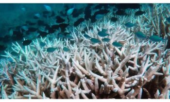
This indicates that about 34 million years ago, Antarctica supported a moderate climate in which luxuriant woods flourished and a large network of rivers sculpted the terrain.
Analyzing the Sediments
34–44 million years ago was an era of extreme cold for Earth. The Earth was ice-free until the “middle to late Eocene” epoch, when a sharp decline in carbon dioxide levels caused the formation of the planet’s first glaciers.
How this event transpired in Antarctica, a region now dominated by ice, has long been a mystery to scientists.
At that time, Antarctica was not an isolated continent. Up until around 100 million years ago, it was a component of the enormous continent Gondwana. Antarctica drifted south and formed its continent as Gondwana broke apart.
Until the end of the Eocene, or about 34 million years ago, Antarctica had a temperate climate, notwithstanding its relocation to the South Pole.
An international team of experts examined the minerals and rock fragments discovered in sand samples taken from the coast of West Antarctica’s Amundsen Sea in this latest study. The samples were gathered while on a research icebreaker named Polarstern.
Remarkably, the majority of these minerals and fragments were not found in West Antarctica; they were found elsewhere. Rather, they indicate a far-off source – the thousands of kilometers away Transantarctic Mountains on the other side of the continent.
The news release claims that the height of this mountain range hasn’t always existed. However, from the late Eocene epoch, they have been gradually expanding.
The West Antarctic Rift System is a geological feature that is associated with this rise. Antarctica is now divided into the East and West geographical masses.
The Mountains’ Ascent
So what’s the connection between all of this and the old river?
Massive amounts of weathered and shifted rocks and minerals were produced by the raising of the Transantarctic Mountains.
This debris was probably transported by the recently discovered river system over a great distance (about 1,500 kilometers) via the West Antarctic Rift System before ending up in the Amundsen Sea.
According to Professor Cornelia Spiegel of the University of Bremen, “the existence of such a transcontinental river system shows that – unlike today – large parts of West Antarctica must have been located above sea level as extensive, flat coastal plains.”
West Antarctica had low topography near the end of the Eocene epoch, according to the press release. West Antarctica was low enough in elevation and too warm for permanent ice sheets to form, even though it was at the South Pole.
On the other hand, the mountainous regions of East Antarctica, which had higher altitudes and lower temperatures, were already seeing the onset of glaciers during that period.
Similar river systems, according to the researchers, can still be found in locations with geological characteristics similar to the West Antarctic Rift System. The Rhine River passes through the Upper Rhine Graben, but the Rio Grande runs via the Rio Grande Rift.